| Zabaykalsky Krai (English) Забайкальский Край (Russian) | |
|---|---|
| - Krai - | |
 | |
 Coat of arms of Zabaykalsky Krai |  Flag of Zabaykalsky Krai |
| Anthem | None[citation needed] |
| Political status | |
| Country | Russia |
| Political status | Krai |
| Federal district | Siberian[1] |
| Economic region | East Siberian[2] |
| Administrative center | Chita[citation needed] |
| Official language | Russian[3] |
| Statistics | |
| Population (2010 Census preliminary results)[4] | 1,106,600 inhabitants |
| - Rank within Russia | 47th |
| - Urban[4] | 65.9% |
| - Rural[4] | 34.1% |
| Population (2002 Census)[5] | 1,155,346 inhabitants |
| - Rank within Russia | 47th |
| - Urban[5] | 63.4% |
| - Rural[5] | 36.1% |
| - Density | 2.68 /km2 (6.9 /sq mi)[6] |
| Area (as of the 2002 Census)[7] | 431,500 km2 (166,603.1 sq mi) |
| - Rank within Russia | 10th |
| Established | March 1, 2008[8] |
| License plates | 91 |
| ISO 3166-2:RU | RU-ZAB |
| Time zone | YAKST (UTC+10:00) |
| Government (as of March 2011) | |
| Governor[9] | Ravil Geniatulin[10] |
| Legislature | Legislative Assembly[9] |
| Charter | Charter of Zabaykalsky Krai |
| Official website | |
| http://www.e-zab.ru | |
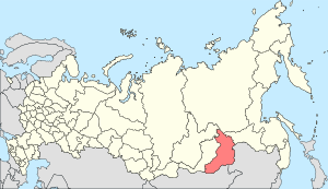
Zabaykalsky Krai (Russian: Забайкальский край, lit. Transbaikal krai) is a federal subject of Russia (a krai) that was created on March 1, 2008 as a result of a merger of Chita Oblast and Agin-Buryat Autonomous Okrug, after a referendum held on the issue on March 11, 2007.
Ravil Geniatulin, the Governor of Chita Oblast, was elected Governor of Zabaykalsky Krai on February 5, 2008 by the majority of the deputies of both Chita Oblast Duma and Agin-Buryat Autonomous Okrug Duma. He assumed the post on March 1, 2008.[11]
Contents[hide] |
[edit] Geography
The krai is located within the historical region of Transbaikalia.
[edit] Borders
The krai has extensive international borders with China (998 km) and Mongolia (868 km) and internal borders with Irkutsk and Amur Oblasts, as well as with the Buryat and the Sakha Republics.
[edit] Administrative divisions
[edit] Demographics-(copy of wikipedia)
The population was mostly Russians and Buryats, along with some Ukrainians and a few Evenks. There were 1,000 Jews in the regional capital. According to the 2002 census, Russians made up 89.8% of the population while Buryats were 6.1%. Other significant groups were Ukrainian (1.03%), Tatars (0.71%), Armenians (0.31%), Belorussian (0.26%), Azeri (0.18%), Evenks (0.13%), Nemts (0.11%), Chuvash (0.11%), Bashkirs (0.11%), Moldovan (0.07%), Mordvin (0.06%), Uzbek (0.06%) and Dargwa (0.05%). Around 92% of the population belonged to Slavic or Germanic ethnic groups, while the remaining were mostly Mongolic.
[edit] Demographics for 2007
- Births: 16,652 (14.84 per 1000, 14.87 in Urban areas & 14.79 in Rural areas).
- Deaths: 16,186 (14.42 per 1000, 14.42 in Urban areas & 14.44 in Rural areas).
- Natural Growth Rate: 0.04% per year (0.05% for Urban areas & 0.04% for Rural areas).
[edit] Demographics for 2008
Source:[12]
- Births: 17,809 (15.9 per 1000)
- Deaths: 16,053 (14.3 per 1000)
- NGR: 0.16%
- Net Immigration: -3,621
No comments:
Post a Comment