The Canary Islands  /kəˈnɛəriː ˈaɪləndz/ (Spanish: Islas Canarias pronounced [ˈislas kaˈnaɾjas]), also known as the Canaries (Spanish: Canarias) are a Spanish archipelago located just off the northwest coast of mainland Africa, 100 km west of the border between Morocco and the Western Sahara. The Canaries are a Spanish autonomous community and an outermost region of the European Union. The islands include (from largest to smallest): Tenerife, Fuerteventura, Gran Canaria, Lanzarote, La Palma, La Gomera, El Hierro, and the islets La Graciosa, Alegranza, Montaña Clara, Roque del Este, Roque del Oeste and Isla de Lobos.
The archipelago's beaches, climate and important natural attractions, especially Teide National Park and Mount Teide (the third largest volcano in the world), make it a major tourist destination, with over 12 million visitors per year, especially Tenerife, Gran Canaria and Lanzarote.[7][8] The islands have a sub-tropical climate, with long hot days in summer and cooler days in winter.[9]
The capital for the Autonomous Community is shared by the cities of Santa Cruz de Tenerife and Las Palmas de Gran Canaria,[10][11] which in turn are the capitals of the provinces of Santa Cruz de Tenerife and Las Palmas. From 1833 until 1927 Santa Cruz de Tenerife was the only capital,[10][11] yet Las Palmas de Gran Canaria is the largest city since 1768, except for a brief period in 1910.[12] The third largest city of the Canary Islands is San Cristóbal de La Laguna (a World Heritage Site) on Tenerife.[13][14][15]
During the times of the Spanish Empire the Canaries were the main stopover for Spanish galleons on their way to America because of the favorable easterly winds.[16]
[edit] Etymology
The name Islas Canarias is likely derived from the Latin term Insula Canaria, meaning "Island of the Dogs", a name applied originally only to Gran Canaria. It is speculated that the so-called dogs were actually a species of Monk Seals ("sea dog" in Latin), critically endangered and no longer present in the Canary Islands.[17] The dense population of seals may have been the characteristic that most struck the few ancient Romans who established contact with these islands by sea. The connection to dogs is retained in their depiction on the islands' coat-of-arms (shown above).
The original inhabitants of the island, Guanches, used to worship dogs, mummified them and treated dogs generally as holy animals[citation needed]. In ancient times the island was well known for its people who worshipped dogs there[citation needed], and when the Romans first visited the island they gave it the name: 'canarii', Latin for "the ones with dogs". The ancient Greeks also knew about a people, living far to the west, who are the "dog-headed ones", who worship dogs on an island[citation needed]. Some theorize that the Canary Islands dog-worship and the ancient Egyptian cult of the dog-headed god, Anubis are closely connected[citation needed], but there is no explanation given as to which one was first.
[edit] Geography

Map of the Canary Islands

Hacha Grande, a mountain in the south of Lanzarote, viewed from the road to the Playa de Papagayo.
[edit] Physical geography
The islands and their capitals are:
Tenerife, with 865,070 inhabitants, is both the Canary Islands' and Spain's most populous island. Tenerife is also the largest island of the archipelago. The island of Fuerteventura is the second largest in the archipelago and located 100 km from the African coast. The islands form the Macaronesia ecoregion with the Azores, Cape Verde, Madeira, and the Savage Isles. The archipelago consists of seven large and several smaller islands, all of which are volcanic in origin.[18] The Teide volcano on Tenerife is the highest mountain in Spain, and the third largest volcano on Earth on a volcanic ocean island. All the islands except La Gomera have been active in the last million years; four of them (Lanzarote, Tenerife, La Palma and El Hierro) have historical records of eruptions since European discovery. The islands rise from Jurassic oceanic crust associated with the opening of the Atlantic. Underwater magmatism commenced during the Cretaceous, and reached the ocean's surface during the Miocene. The islands are considered as a distinct physiographic section of the Atlas Mountains province, which in turn is part of the larger African Alpine System division.
According to the position of the islands with respect to the NE trade winds, the climate can be mild and wet or very dry. Several native species form laurisilva forests.
Four of Spain's thirteen national parks are located in the Canary Islands, more than any other autonomous community. Teide National Park is the most visited in Spain, and the oldest and largest within the Canary Islands. The parks are:
The following table shows the highest mountains in each of the islands;
[edit] Climate
| [hide]Climate data for Las Palmas de Gran Canaria, capital of Gran Canaria island |
| Month | Jan | Feb | Mar | Apr | May | Jun | Jul | Aug | Sep | Oct | Nov | Dec | Year |
| Average high °C (°F) | 20.6
(69.1) | 21.0
(69.8) | 21.8
(71.2) | 22.1
(71.8) | 23.1
(73.6) | 24.7
(76.5) | 26.5
(79.7) | 27.1
(80.8) | 27.1
(80.8) | 25.8
(78.4) | 23.8
(74.8) | 21.8
(71.2) | 23.7
(74.7) |
| Daily mean °C (°F) | 17.6
(63.7) | 17.9
(64.2) | 18.6
(65.5) | 18.9
(66) | 20.0
(68) | 21.7
(71.1) | 23.4
(74.1) | 24.1
(75.4) | 24.1
(75.4) | 22.7
(72.9) | 20.8
(69.4) | 18.7
(65.7) | 20.7
(69.3) |
| Average low °C (°F) | 14.7
(58.5) | 14.9
(58.8) | 15.4
(59.7) | 15.7
(60.3) | 17.0
(62.6) | 18.7
(65.7) | 20.4
(68.7) | 21.2
(70.2) | 21.2
(70.2) | 19.7
(67.5) | 17.9
(64.2) | 15.7
(60.3) | 17.7
(63.9) |
| Precipitation mm (inches) | 18
(0.71) | 24
(0.94) | 14
(0.55) | 7
(0.28) | 2
(0.08) | 0
(0) | 0
(0) | 0
(0) | 10
(0.39) | 13
(0.51) | 18
(0.71) | 27
(1.06) | 133
(5.24) |
| Avg. precipitation days (≥ 1 mm) | 3 | 3 | 3 | 1 | 0 | 0 | 0 | 0 | 1 | 2 | 3 | 4 | 21 |
| Sunshine hours | 191 | 192 | 218 | 224 | 265 | 281 | 304 | 294 | 238 | 218 | 191 | 189 | 2,805 |
| Source: World Meteorological Organization (UN),[19] Agencia Estatal de Meteorología[20] |
| [hide]Climate data for Santa Cruz de Tenerife, capital of Tenerife island |
| Month | Jan | Feb | Mar | Apr | May | Jun | Jul | Aug | Sep | Oct | Nov | Dec | Year |
| Average high °C (°F) | 20.6
(69.1) | 20.9
(69.6) | 21.7
(71.1) | 22.3
(72.1) | 23.7
(74.7) | 25.7
(78.3) | 28.3
(82.9) | 28.8
(83.8) | 27.9
(82.2) | 26.0
(78.8) | 23.9
(75) | 21.8
(71.2) | 24.3
(75.7) |
| Daily mean °C (°F) | 17.9
(64.2) | 18.0
(64.4) | 18.7
(65.7) | 19.2
(66.6) | 20.6
(69.1) | 22.4
(72.3) | 24.6
(76.3) | 25.1
(77.2) | 24.6
(76.3) | 23.0
(73.4) | 21.0
(69.8) | 19.0
(66.2) | 21.2
(70.2) |
| Average low °C (°F) | 15.1
(59.2) | 15.1
(59.2) | 15.6
(60.1) | 16.2
(61.2) | 17.5
(63.5) | 19.0
(66.2) | 20.8
(69.4) | 21.4
(70.5) | 21.3
(70.3) | 20.0
(68) | 18.1
(64.6) | 16.2
(61.2) | 18.0
(64.4) |
| Precipitation mm (inches) | 34
(1.34) | 36
(1.42) | 29
(1.14) | 14
(0.55) | 4
(0.16) | 1
(0.04) | 0
(0) | 1
(0.04) | 6
(0.24) | 18
(0.71) | 27
(1.06) | 44
(1.73) | 214
(8.43) |
| Avg. precipitation days (≥ 1 mm) | 5 | 4 | 4 | 3 | 1 | 0 | 0 | 0 | 1 | 3 | 4 | 6 | 31 |
| Sunshine hours | 178 | 186 | 216 | 226 | 272 | 297 | 330 | 316 | 251 | 219 | 185 | 175 | 2,851 |
| Source: Agencia Estatal de Meteorología[21] |
[edit] Geology
The originally volcanic islands –seven major islands, one minor island, and several small islets– were formed by the Canary hotspot. The Canary Islands is the only place in Spain where volcanic eruptions have been recorded during the Modern Era, with some volcanoes still active (even though recently inactive).[22]
[edit] Political geography
The Autonomous Community of the Canary Islands consists of two provinces, Las Palmas and Santa Cruz de Tenerife, whose capitals (Las Palmas de Gran Canaria and Santa Cruz de Tenerife) are capitals of the autonomous community. Each of the seven major islands is ruled by an island council named cabildo insular.
The international boundary of the Canaries is the subject of dispute between Spain and Morocco. Morocco does not agree that the laws regarding territorial limits allow Spain to claim for itself seabed boundaries based on the territory of the Canaries, because the Canary Islands are autonomous. In fact, the islands do not enjoy any special degree of autonomy as each one of the Spanish regions is considered an autonomous community. Under the Law of the Sea, the only islands not granted territorial waters or an Exclusive Economic Zone (EEZ) are those that are not fit for human habitation or do not have an economic life of their own, which is clearly not the case of the Canary Islands.
The boundary is relevant for possible seabed oil deposits and other ocean resource exploitation. Morocco therefore does not formally agree to the territorial boundary; it rejected a 2002 unilateral Spanish proposal.[23]
The Islands have 13 seats in the Spanish Senate. Of these, 11 seats are directly elected, 3 for Gran Canaria, 3 for Tenerife, 1 for each other island; 2 seats are indirectly elected by the regional Autonomous Government. The local government is presided over by Paulino Rivero, the current President of the Canary Islands.[24]
[edit] History
[edit] Ancient and pre-colonial times
Before the arrival of the aborigines, the Canaries were inhabited by prehistoric animals; for example, the giant lizard (Gallotia goliath), or giant rats (Canariomys bravoi and Canariomys tamarani).[25]
The islands were visited by the Phoenicians, the Greeks, and the Carthaginians. According to the 1st century AD Roman author and philosopher Pliny the Elder, the archipelago was found to be uninhabited when visited by the Carthaginians under Hanno the Navigator, but that they saw ruins of great buildings.[26] This story may suggest that the islands were inhabited by other peoples prior to the Guanches. King Juba, Augustus's Roman protege, is credited with discovering the islands for the Western world. He dispatched a naval contingent to re-open the dye production facility at Mogador in what is now western Morocco in the early 1st century AD.[27] That same naval force was subsequently sent on an exploration of the Canary Islands, using Mogador as their mission base.
When the Europeans began to explore the islands, they encountered several indigenous populations living at a Neolithic level of technology. Although the history of the settlement of the Canary Islands is still unclear, linguistic and genetic analyses seem to indicate that at least some of these inhabitants shared a common origin with the Berbers of northern Africa.[28] The pre-colonial inhabitants came to be known collectively as the Guanches, although Guanches was originally the name for the indigenous inhabitants of Tenerife.
During the Middle Ages, the islands were visited by the Arabs for commercial purposes. The Muslim navigator Ibn Farrukh, from Granada, is said to have landed in "Gando" (Gran Canaria) in February 999, visiting a king named Guanarigato.[citation needed] From the 14th century onward, numerous visits were made by sailors from Majorca, Portugal, and Genoa. Lancelotto Malocello settled on Lanzarote in 1312. The Majorcans established a mission with a bishop in the islands that lasted from 1350 to 1400.
[edit] Castilian conquest
There are claims that the Portuguese had "discovered" the Canaries as early as 1336, though there appears to be little evidence for this.[29] In 1402, the Castilian conquest of the islands began, with the expedition of French adventurers Jean de Béthencourt and Gadifer de la Salle, nobles and vassals of Henry III of Castile, to Lanzarote. From there, they conquered Fuerteventura ( 1405 ) and El Hierro. Béthencourt received the title King of the Canary Islands, but still recognized King Henry III as his overlord.
Béthencourt also established a base on the island of La Gomera, but it would be many years before the island was truly conquered. The natives of La Gomera, and of Gran Canaria, Tenerife, and La Palma, resisted the Castilian invaders for almost a century. In 1448 Maciot de Béthencourt sold the lordship of Lanzarote to Portugal's Prince Henry the Navigator, an action that was not accepted by the natives nor by the Castilians. A crisis swelled to a revolt which lasted until 1459 with the final expulsion of the Portuguese. In 1479, Portugal and Castile signed the Treaty of Alcáçovas. The treaty settled disputes between Castile and Portugal over the control of the Atlantic, in which Castilian control of the Canary islands was recognized but which also confirmed Portuguese possession of the Azores, Madeira, the Cape Verde islands and gave them rights to lands discovered and to be discovered...and any other island which might be found and conquered from the Canary islands beyond toward Guinea.
The Castilians continued to dominate the islands, but due to the topography and the resistance of the native Guanches, complete pacification was not achieved until 1495, when Tenerife and La Palma were finally subdued by Alonso Fernández de Lugo. After that, the Canaries were incorporated into the Kingdom of Castile.
[edit] After the conquest
After the conquest, the Castilians imposed a new economic model, based on single-crop cultivation: first sugar cane; then wine, an important item of trade with England. In this era, the first institutions of colonial government were founded. Both Gran Canaria, a colony of Castile since March 6, 1480 (from 1556, of Spain), and Tenerife, a Spanish colony since 1495, had separate governors.
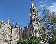
The cities of Santa Cruz de Tenerife and Las Palmas de Gran Canaria became a stopping point for the Spanish conquerors, traders, and missionaries on their way to the New World. This trade route brought great prosperity to some of the social sectors of the islands. The islands became quite wealthy and soon were attracting merchants and adventurers from all over Europe. Magnificent palaces and churches were built on La Palma during this busy, prosperous period. The Church of El Salvador survives as one of the island's finest examples of the architecture of the 16th century.
The Canaries' wealth invited attacks by pirates and privateers. Ottoman Turkish admiral and privateer Kemal Reis ventured into the Canaries in 1501, while Murat Reis the Elder captured Lanzarote in 1585.
Church of San Juan Bautista,
Arucas in Gran Canaria.
The most severe attack took place in 1599, during the Dutch War of Independence. A Dutch fleet of 74 ships and 12,000 men, commanded by Johan van der Does, attacked the capital, Las Palmas (the city had 3,500 of Gran Canaria's 8,545 inhabitants). The Dutch attacked the Castillo de la Luz, which guarded the harbor. The Canarians evacuated civilians from the city, and the Castillo surrendered (but not the city). The Dutch moved inland, but Canarian cavalry drove them back to Tamaraceite, near the city.
The Dutch then laid siege to the city, demanding the surrender of all its wealth. They received 12 sheep and 3 calves. Furious, the Dutch sent 4,000 soldiers to attack the Council of the Canaries, who were sheltering in the village of Santa Brígida. 300 Canarian soldiers ambushed the Dutch in the village of Monte Lentiscal, killing 150 and forcing the rest to retreat. The Dutch concentrated on Las Palmas, attempting to burn it down. The Dutch pillaged Maspalomas, on the southern coast of Gran Canaria, San Sebastian on La Gomera, and Santa Cruz on La Palma, but eventually gave up the siege of Las Palmas and withdrew.
Another noteworthy attack occurred in 1797, when Santa Cruz de Tenerife was attacked by a British fleet under the future Lord Nelson on 25 July. The British were repulsed, losing almost 400 men. It was during this battle that Nelson lost his right arm.
[edit] 18th to 19th century
The sugar-based economy of the islands faced stiff competition from Spain's American colonies. Crises in the sugar market in the 19th century caused severe recessions on the islands. A new cash crop, cochineal (cochinilla), came into cultivation during this time, saving the islands' economy.
By the end of the 18th century, Canary Islanders had already emigrated to Spanish American territories, such as Havana, Veracruz, Santo Domingo,[30] San Antonio, Texas[31] and St. Bernard Parish, Louisiana[32][33] These economic difficulties spurred mass emigration, primarily to the Americas, during the 19th and first half of the 20th century. From 1840 to 1890, as many as 40,000 Canary Islanders emigrated to Venezuela. Also, thousands of Canarians moved to Puerto Rico; the Spanish monarchy felt that Canarians would adapt to island life better than other immigrants from the mainland of Spain. Deeply entrenched traditions, such as the Mascaras Festival in the town of Hatillo, Puerto Rico, are an example of Canarian culture still preserved in Puerto Rico. Similarly, many thousands of Canarians emigrated to the shores of Cuba as well.[34] During the Spanish-American War of 1898, the Spanish fortified the islands against possible American attack, but an attack never came.
[edit] Romantic period and scientific expeditions

Coast El Golfo, El Hierro
Sirera and Renn (2004)[35] distinguish two different types of expeditions, or voyages, during the period 1770-1830, which they term "the Romantic period”:
First are “expeditions financed by the States, closely related with the official scientific Institutions. characterized by having strict scientific objectives (and inspired by) the spirit of Illustration and progress”. In this type of expedition, Sirera and Renn include the following travellers:
- the British citizen Edens (1715) who ascends Mount Teide and publishes his story in Philosophical Transactions.
- Louis Feuillée (1724), who was sent to measure the meridian of El Hierro and to map the islands.
- Jean-Charles de Borda (1771, 1776) who more accurately measured the longitudes of the islands and the height of Mount Teide
- the Baudin-Ledru expedition (1796) which aimed to recover a valuable collection of natural history objects.
The second type of expedition identified by Sirera and Renn is one that took place starting from more or less private initiatives. Among these, the key exponents were the following:
Sirera and Renn identify the period 1770-1830 as one in which “In a panorama dominated until that moment by France and England enters with strength and brio Germany of the Romantic period whose presence in the islands will increase”.
[edit] Early 20th century

Casa de Colón y Pilar Nuevo (Gran Canaria)
At the beginning of the 20th century, the British introduced a new cash-crop, the banana, the export of which was controlled by companies such as Fyffes.
The rivalry between the elites of the cities of Las Palmas de Gran Canaria and Santa Cruz de Tenerife for the capital of the islands led to the division of the archipelago into two provinces in 1927. This has not laid to rest the rivalry between the two cities, which continues to this day.
During the time of the Second Spanish Republic, Marxist and anarchist workers' movements began to develop, led by figures such as Jose Miguel Perez and Guillermo Ascanio. However, outside of a few municipalities, these organizations were a minority and fell easily to Nationalist forces during the Spanish Civil War.
[edit] Franco regime
In 1936, Francisco Franco was appointed General Commandant of the Canaries. He joined the military revolt of July 17 which began the Spanish Civil War. Franco quickly took control of the archipelago, except for a few points of resistance on La Palma and in the town of Vallehermoso, on La Gomera. Though there was never a proper war in the islands, the post-war repression on the Canaries was most severe.[citation needed]
During the Second World War, Winston Churchill prepared plans for the British seizure of the Canary Islands as a naval base, in the event of Gibraltar being invaded from the Spanish mainland.
Opposition to Franco's regime did not begin to organize until the late 1950s, which experienced an upheaval of parties such as the Communist Party of Spain and the formation of various nationalist, leftist parties.
After the death of Franco, there was a pro-independence armed movement based in Algeria, the MPAIAC. Now there are some pro-independence political parties, like the CNC and the Popular Front of the Canary Islands, but none of them calls for an armed struggle. Their popular support is insignificant, with no presence in either the autonomous parliament or the cabildos insulares.
After the establishment of a democratic constitutional monarchy in Spain, autonomy was granted to the Canaries via a law passed in 1982. In 1983, the first autonomous elections were held. The Spanish Socialist Workers' Party (PSOE) won. In the most recent autonomous elections (2007), the PSOE gained a plurality of seats, but the nationalist Canarian Coalition and the conservative Partido Popular (PP) formed a ruling coalition government.[37] Still, the 1977 bombing of a flower shop in Gran Canaria-Gando airport and the threat of another bomb, both claimed by an pro-independence group, led to the major air disaster in Los Rodeos airport in Tenerife, which claimed hundreds of victims, the deadliest result of an indepence group bombing and threats unsurpassed by 2009.[citation needed]
[edit] Demographics
| Population history[38] |
| Year | Population |
| 1768 | 155,763 |
| 1787 | 168,928 |
| 1797 | 173,865 |
| 1842 | 241,266 |
| 1860 | 237,036 |
| 1887 | 301,983 |
| 1900 | 364,408 |
| 1920 | 488,483 |
| 1940 | 687,937 |
| 1960 | 966,177 |
| 1981 | 1,367,646 |
| 1990 | 1,589,403 |
| 2000 | 1,716,276 |
| 2008 | 2,075,968 |
| 2009 | 2,098,593 |
| Figures between 1768-2008. |
| Demographics of the Canary Islands (2009)[39] |
| Nationality | Population | Percent |
|
| Canarian | 1,547,611 | 73.7% |
| Mainland Spanish (Peninsulares) | 178,613 | 12.0% |
| Total Spanish | 1,802,788 | 85.7% |
| Spanish-born | 1,726,315 | 85.7% |
| Foreign nationals | 301,204 | 14.3% |
| Foreign-born | 377,677 | 14.3% |
|
| Total | 2,103,992 | 100% |
The Canary Islands have a population of 2,100,235 inhabitants (2011), making it the eighth most populous of Spain's autonomous communities, with a density of 281.8 inhabitants per km². The total area of the archipelago is 7447 km².[40]
The Canarian population includes long-tenured residents and new waves of mainland Spanish immigrants (including Galicians, Castilians, Catalans, Basques), as well as Portuguese, Italians, Flemings and Britons. Of the total Canarian population in 2009 (2,098,593) 1,799,373 were Spanish (1,547,611 native Canarian and 178,613 from the Spanish mainland) and 299,220 foreigners. Of these, the majority are Europeans (55%), including Germans (39,505), British (37,937) and Italians (24,177). There are also 86,287 inhabitants from the Americas, mainly Colombians (21,798), Venezuelans (11,958), Cubans (11,098) and Argentines (10,159). There are also 28,136 African residents, mostly Moroccans (16,240).[41]
[edit] Population of the individual islands
The population of the islands according the 2010 data are:[42]
[edit] Religion
The overwhelming majority of native Canarians are Roman Catholic with various smaller foreign-born populations of other Christian beliefs such as Protestants from northern Europe and Africans following Islam. Other restorationist Christian religions are also represented, such as The Church of Jesus Christ of Latter-day Saints. There is also an important community of Hindus. Another minority religion is the more recent Church of the Guanche People, which is classified as neo-pagan religion. The appearance of the Virgin of Candelaria (Patron of Canary Islands)[43],[44],[45],[46],[47] was credited with moving the Canary Islands toward Christianity.
The Canary Islands are divided into two Catholic dioceses, each governed by a bishop:
[edit] Population genetics
[edit] Islands
[edit] Tenerife
Tenerife is, with its area of 2,034 km², the most extensive island of the Canary Islands. In addition, the 906,854 inhabitants makes it the most populous island in Spain. Two of the islands principal cities are located on it: Santa Cruz de Tenerife and San Cristóbal de La Laguna (a World Heritage Site). Santa Cruz is the capital of Tenerife and seat of the Parliament of the Canary Islands. Santa Cruz de Tenerife shares the status of capital of the Canaries with Las Palmas de Gran Canaria. San Cristobal de La Laguna, the second city of the island is home to the oldest university in the Canary Islands. The Teide, with its 3,718 m is the highest peak of Spain and also a World Heritage Site. This island is in the province of Santa Cruz de Tenerife.
[edit] Gran Canaria
Gran Canaria is the second most populated island, with 829,597 inhabitants. The capital, Las Palmas de Gran Canaria (377,203 inhabitants), is the most populous city and shares the status of capital of the Canaries with Santa Cruz de Tenerife. Gran Canaria's surface area is 1,560 km². In center of the island lie the Roque Nublo (1,813 m) and Pico de las Nieves ("Peak of Snow") (1,949 m).
[edit] La Palma
La Palma, with 86,528 inhabitants, covering an area of 708.32 km² is in its entirety a biosphere reserve. It shows no recent signs of volcanic activity, even though the volcano Teneguía entered into eruption last in 1971. In addition, it is the second-highest island of the Canaries, with the Roque de los Muchachos (2,423 m) as highest point. Santa Cruz de La Palma (known to those on the island as simply "La Palma") is its capital.
[edit] Lanzarote
Lanzarote, is the easternmost island and one of the most ancient of the archipelago, and it has shown evidence of recent volcanic activity. It has a surface of 845.94 km², and a population of 139,506 inhabitants including the adjacent islets of the Chinijo Archipelago. The capital is Arrecife, with 56,834 inhabitants.
[edit] Chinijo Archipelago
The Chinijo Archipelago includes the islands La Graciosa, Alegranza, Montaña Clara, Roque del Este and Roque del Oeste.
La Graciosa, is the smallest inhabited island of the Canaries, and the major island of the Chinijo Archipelago. The whole archipelago is administrated by Lanzarote. It has a surface of 29.05 km2 (11 sq mi), and a population of 658 inhabitants. The capital is Caleta de Sebo, with 656 inhabitants.
[edit] El Hierro
El Hierro, the westernmost island, covers 268.71 km², making it the smallest of the major islands, and the least populous with 10,753 inhabitants. The whole island was declared Reserve of the Biosphere in 2000. Its capital is Valverde, Santa Cruz de Tenerife. Also known as Ferro, it was once believed to be the westernmost land in the world.
[edit] Fuerteventura
Fuerteventura, with a surface of 1,659 km², is the second-most extensive island of the archipelago, as well as the second most oriental. It has been declared a Biosphere reserve by Unesco. It has a population of 100,929. Being also the most ancient of the islands, it is the one that is more eroded: its highest point is the Peak of the Bramble, at a height of 807 m. Its capital is Puerto del Rosario.
[edit] La Gomera
La Gomera, has an area of 369.76 km² and is the second least populous island with 22,622 inhabitants. Geologically it is one of the oldest of the archipelago. The insular capital is San Sebastian de La Gomera. Garajonay's National Park is here.
[edit] Data of islands
| Flag | Coat of arms | Island | Capital | Area (km²) | Population (2010) |
 |  | El Hierro | Valverde | 268.71 | 10,960 |
 |  | Fuerteventura | Puerto del Rosario | 1,659 | 103,492 |
 |  | Gran Canaria | Las Palmas de Gran Canaria | 1,560.1 | 845,676 |
 |  | La Gomera | San Sebastián de La Gomera | 369.76 | 22,776 |
 |  | Lanzarote | Arrecife | 845.94 | 141,437 |
 |  | La Palma | Santa Cruz de La Palma | 708.32 | 86,324 |
 |  | Tenerife | Santa Cruz de Tenerife | 2,034.38 | 906,854 |
[edit] Economy
Tourism in the Canary Islands[48] | Year | Visitors |
|
2009
(Jan-Jun) | 4,002,013 |
| 2008 | 9,210,509 |
| 2007 | 9,326,116 |
| 2006 | 9,530,039 |
| 2005 | 9,276,963 |
| 2004 | 9,427,265 |
| 2003 | 9,836,785 |
| 2002 | 9,778,512 |
| 2001 | 10,137,202 |
| 2000 | 9,975,977 |
| 1993 | 6,545,396 |
|
Largest by
Country (2008) | Population |
| Germany | 2,498,847 |
| Great Britain | 3,355,942 |
The economy is based primarily on tourism, which makes up 32% of the GDP. The Canaries receive about 12 million tourists per year. Construction makes up nearly 20% of the GDP and tropical agriculture, primarily bananas and tobacco, are grown for export to Europe and the Americas. Ecologists are concerned that the resources, especially in the more arid islands, are being overexploited but there are still many agricultural resources like tomatoes, potatoes, onions, cochineal, sugarcane, grapes, vines, dates, oranges, lemons, figs, wheat, barley, maize, apricots, peaches and almonds.
The economy is € 25 billion (2001 GDP figures). The islands experienced continuous growth during a 20 year period, up until 2001, at a rate of approximately 5% annually. This growth was fueled mainly by huge amounts of Foreign Direct Investment, mostly to develop tourism real estate (hotels and apartments), and European Funds (near € 11 billion euro in the period from 2000 to 2007), since the Canary Islands are labelled Region Objective 1 (eligible for euro structural funds). Additionally, the EU allows the Canary Islands Government to offer special tax concessions for investors who incorporate under the Zona Especial Canaria (ZEC) regime and create more than 5 jobs.
The Canary Islands have great natural attractions, climate and beaches make the islands a major tourist destination, being visited each year by about 12 million people (11,986,059 in 2007, noting 29% of Britons, 22% of Spanish, not residents of the Canaries, and 21% of Germans). Among the islands, Tenerife has the largest number of tourists received annually, followed by Gran Canaria and Lanzarote.[7][8] The archipelago's principal tourist attraction is the Teide National Park (in Tenerife) where the highest mountain in Spain and third largest volcano in the world (Mount Teide), receives over 2.8 million visitors annually.[49]
The combination of high mountains, proximity to Europe, and clean air has made the Roque de los Muchachos peak (on La Palma island) a leading location for telescopes like the Grantecan.
The islands are outside the European Union customs territory and VAT area, though politically within the EU. Instead of VAT there is a local Sales Tax (IGIC) which has a general rate of 5%, an increased tax rate of 12%, a reduced tax rate of 2% and a zero tax rate for certain basic need products and services (e.g. telecommunications).
Canarian time is Western European Time (WET) (or GMT; in summer one hour ahead of GMT). So Canarian time is one hour behind that of mainland Spain and the same as that of the UK; Ireland and Portugal all year round.
[edit] Transport
The Canary Islands have eight airports altogether, two of the main ports of Spain, and an extensive network of autopistas (highways) and other roads. For a road map see multimap.[50]
There are large ferry boats that link islands as well as fast ferries linking most of the islands. Both types can transport large numbers of passengers and cargo (including vehicles). Fast ferries are made of aluminium and powered by modern and efficient diesel engines, while conventional ferries have a steel hull and are powered by heavy oil. Fast ferries travel relatively fast (in excess of 30 knots) and are a faster method of transportation than the conventional ferry (some 20 knots). A typical ferry ride between La Palma and Tenerife may take up to eight hours or more while a fast ferry takes about 2 and a half hours and between Tenerife and Gran Canaria can be about one hour.
The largest airport is the Gran Canaria airport, with about 10,000,000 passengers. It is also the 5th largest airport in Spain. The biggest port is in Las Palmas. It is an important port for commerce with Europe, Africa and the Americas. It is the 4th biggest commercial port in Spain with more than 1,400,000 TEU's. The largest commercial companies of the world,including MSC and Maersk, operate here. In this port there is an international post of the Red Cross, one of only four points like this all around the world. Tenerife has two airports, Tenerife North Airport (4,048,281 passengers) and Tenerife South Airport (6,939,168 passengers).[51]
Canary Islands has an input of 16,874,532 passengers. The two main islands (Tenerife and Gran Canaria) receive the greatest number of passengers; Tenerife 6,204,499 passengers and Gran Canaria 5,011,176 passengers.[52]
The port of Las Palmas is first in freight traffic in the islands,[53] while the port of Santa Cruz de Tenerife is the first fishing port with approximately 7,500 tons of fish caught, according to the Spanish government publication Statistical Yearbook of State Ports. Similarly, it is the second port in Spain as regards ship traffic, only surpassed by the Port of Algeciras Bay.[54] The port's facilities include a border inspection post (BIP) approved by the European Union, which is responsible for inspecting all types of imports from third countries or exports to countries outside the European Economic Area. The port of Los Cristianos (Tenerife) has the greatest number of passengers recorded in the Canary Islands, followed by the port of Santa Cruz de Tenerife.[55] The Port of Las Palmas is the third port in the islands in passengers and first in number of vehicles transported.[55]
[edit] Rail transport

The tram in
La Laguna, Tenerife during a test run (2007).
The Tenerife Tram opened in 2007 and is the only one in the Canary Islands, travels between the cities of Santa Cruz de Tenerife and San Cristóbal de La Laguna. It is currently planned construction of three trains in the Canary Islands (two in Tenerife and one in Gran Canaria). Tenerife trains would travel north and south of the island. Connect the cities of Santa Cruz (capital) and Los Cristianos (south), and the cities of Santa Cruz and Los Realejos (north). The train travels the distance Gran Canaria from Las Palmas to Maspalomas (south).[56][57]
[edit] Airports
[58]
[edit] Wildlife
The official symbols from nature associated with Canary Islands are the bird Serinus canaria (Canary) and the Phoenix canariensis palm.[59]
[edit] Terrestrial wildlife
With a range of habitats, the Canary Islands exhibit diverse plant species. The bird life includes European and African species, such as the Black-bellied Sandgrouse; and a rich variety of endemic (local) taxa including the:
Terrestrial fauna includes geckos (such as the striped Canary Islands Gecko) and wall lizards, and three endemic species of recently rediscovered and critically endangered giant lizard: the El Hierro Giant Lizard (or Roque Chico de Salmor Giant Lizard), La Gomera Giant Lizard, and La Palma Giant Lizard. Mammals include the Canarian Shrew, Canary Big-Eared Bat, the Algerian Hedgehog (which may have been introduced) and the more recently introduced Mouflon. Some endemic mammals, the Lava Mouse, Tenerife Giant Rat and Gran Canaria Giant Rat, are extinct, as are the Canary Islands Quail, Long-legged Bunting, and the Eastern Canary Islands Chiffchaff.
[edit] Marine life
The Marine life found in the Canary Islands is also varied, being a combination of North Atlantic, Mediterranean and endemic species. In recent years, the increasing popularity of both scuba diving and underwater photography have provided biologists with much new information on the marine life of the islands.
Fish species found in the islands include many species of shark, ray, moray eel, bream, jack, grunt, scorpionfish, triggerfish, grouper, goby, and blenny. In addition, there are many invertebrate species including sponge, jellyfish, anemone, crab, mollusc, sea urchin, starfish, sea cucumber and coral.
There are a total of 5 different species of marine turtle that are sighted periodically in the islands, the most common of these being the endangered loggerhead sea turtle.[60] The other four are the green sea turtle, hawksbill sea turtle, leatherback sea turtle and Kemp's ridley sea turtle. Currently, there are no signs that any of these species breed in the islands, and so those seen in the water are usually migrating. However, it is believed that some of these species may have bred in the islands in the past, and there are records of several sightings of leatherback sea turtle on beaches in Fuerteventura, adding credibility to the theory.
Marine mammals include the Short-Finned Pilot Whale, Common and Bottlenose dolphins. The Canary Islands were also formerly home to a population of the rarest Pinniped in the world, the Mediterranean Monk Seal.
[edit] National Parks of the Canary Islands
The Canary Islands officially has four national parks, of which two have been declared World Heritage Site by UNESCO, and the other two declared a World Biosphere Reserve, these national parks are:[61]
- Caldera de Taburiente National Park (La Palma): Created in 1954 and declared a World Biosphere Reserve in 2002. It currently covers an area of 46.9 km².
- Garajonay National Park (La Gomera): Created in 1981 and declared in 1986 as a World Heritage Site. Its area is 3986 hectares at the core and some areas north of the island.
- Timanfaya National Park (Lanzarote): Created in 1974 and declared a Biosphere Reserve in 1993, together with the whole island. Occupies an area of 51.07 km ², is located in the southwest of the island.
- Teide National Park (Tenerife): Created in 1954, was declared a World Heritage Site in 2007. It covers an area of 18,990 hectares, is the oldest and largest national park in the Canary Islands and one of the oldest in Spain. The Teide in 2010 became the most visited national park in Europe and second worldwide.[1][2] Located in the geographic center of the island is the most visited National Park in Spain. The highlight is the Teide at 3,718 meters altitude, is the highest elevation of the country and the third largest volcano on Earth from its base. Teide National Park was declared in 2007 as one of the 12 Treasures of Spain.
[edit] Sports
A unique form of wrestling known as Canarian wrestling (lucha canaria) has opponents stand in a special area called a "terrero" and try to throw each other to the ground using strength and quick movements.[63]
Another sport is the "game of the sticks" where opponents fence with long sticks. This may have come about from the shepherds of the islands who would challenge each other using their long walking sticks.[63]
Another sport is called the Shepherd's jump. This involves using a long stick to vault over an open area. This sport possibly evolved from the shepherd's need to occasionally get over an open area in the hills as they were tending their sheep.[63]
The two main football teams in the archipelago are: the CD Tenerife (founded in 1912) and UD Las Palmas (founded in 1949).
[edit] Notable athletes
One native of the Canary Islands played Major League Baseball: Alfredo Cabrera, born there in 1881; he played shortstop for the St. Louis Cardinals in 1913.
Another native of the Canary Islands played in the National Basketball Association : Sergio Rodríguez, born there in 1986; he played point guard for the New York Knicks.
David Silva, born in Arguineguin (south of Gran Canaria, Mogan) plays for Manchester City FC. Silva was regarded as one of the best attacking midfielders in the Spanish First Division during his time at FC Valencia, also being credited for his excellent football during the 2008 UEFA European Football Championship, helping the Spanish football team win the competition. He played with the Spanish football team during the 2010 FIFA World Cup in South Africa, helping them to the country's first World Cup trophy.
Pedrito, born in Tenerife plays for FC Barcelona. He played with the Spanish football team during the 2010 FIFA World Cup in South Africa.
Carla Suárez Navarro a tennis player, was born in Las Palmas de Gran Canaria
[edit] See also
[edit] History
[edit] Geography
[edit] Culture
[edit] Neighbours-(COPY OF WIKIPEDIA)


